Earthquake predictions have long been a topic of immense interest for both scientific research and public safety. Earthquakes, complex natural phenomena occurring deep within the Earth's crust, to an average depth of about 700 km, pose a substantial challenge for accurate predictions. This post aims to elucidate the intricacies of earthquake prediction, the causes, and the technology used to monitor seismic activities.
The Science Behind Earthquakes: Plate Tectonics and Faults
Understanding earthquakes begins with the study of plate tectonics. As per this theory, the Earth's lithosphere comprises multiple plates floating on the plastic asthenosphere beneath. These plates, powered by mantle convection currents, are in constant movement. This movement can lead to plate convergence, divergence, or transcurrent faults, all of which can result in earthquakes due to stress buildup from friction.
Case Study: The Haicheng Earthquake Prediction of 1975
Interestingly, there's only one documented successful earthquake prediction - the Haicheng earthquake in China, 1975. Warning signs, including minor quakes, ground uplifts, and other anomalies, prompted the evacuation of thousands. Still, the 7.3 magnitude quake resulted in over 1,000 fatalities and close to 20,000 injuries, despite the preventive measures.
Forecasting Earthquakes: Parameters to Consider
Contrary to common misconceptions, there's no scientific connection between weather conditions and earthquakes. Instead, earthquake predictions rely on multiple geophysical parameters and anomalies. Certain gases like radon, changes in water's chemical composition in wells, and constant rock deformations are potential earthquake precursors. Alterations in seismic wave speeds have also been linked to upcoming earthquakes.
Seismic Activity Monitoring: The Role of Seismographs and GPS Sensors
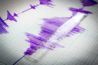
Seismographs play a pivotal role in monitoring earthquakes, registering ground vibrations caused by seismic activities. The data recorded, including the magnitude, depth, and duration of seismic events, is essential for understanding a region's seismicity and evaluating seismic risks.
In addition to seismographs, GPS sensors are crucial for observing Earth's crust deformation. They record the geographic position changes of specific points on Earth, thus enabling the detection of even minor displacements. A network of GPS sensors installed in seismically active regions allows scientists to monitor changes in the Earth's crust's shape and position over time.
Satellites also play a key role in seismic monitoring. Satellite images make it possible to monitor surface changes caused by earthquakes, such as fractures, ground deformation and changes in land use. Interferometric radar satellites, in particular, can measure with great accuracy the deformation of the earth's surface before and after an earthquake. These data make it possible to calculate the amount of displacement caused by seismic shaking, providing valuable information for earthquake modeling and forecasting. In addition, satellites can detect changes in surface temperature and vegetation deformation that can be related to the effects of earthquakes.
Earthquake forecasting methods
One of the most widely used methods of earthquake prediction is continuous monitoring of geologic faults. Networks of sensitive seismometers detect the small seismic tremors that often precede major earthquakes. Changes in the shape of the Earth's crust, such as deformation or ground uplift, can be signs of impending earthquakes. Some studies suggest that the release of radon, a radioactive gas, from the earth's crust may be related to seismic activity. Measuring radon concentrations in certain geographical areas may thus provide clues to the likelihood of impending earthquakes. Other research investigates variations in Earth's electromagnetic fields as possible precursors to earthquakes. This methodology, however, is still being studied. Scientists also use sophisticated statistical analyses based on historical data and trends to assess the probability of earthquakes in specific geographical areas.
Short-term earthquake prediction
Short-term earthquake prediction is a complex challenge, but seismologists are making progress in monitoring earthquake activity in real time. One of the main approaches for short-term earthquake prediction is to use real-time data from a network of seismographs and GPS sensors. These instruments detect small movements and deformations in the Earth's crust that can be precursors to an impending earthquake. For example, sudden changes in seismic wave velocity or an increase in deformation may indicate increased stress in the fault. To analyze and interpret real-time data, scientists develop complex algorithms. These algorithms try to detect patterns and trends in the data that could indicate the possibility of an earthquake. For example, analyzing changes in the frequency and intensity of earthquake shaking can identify increasing seismic activity in a given area.
Long-term earthquake prediction
Long-term earthquake prediction is a highly complex field that relies on a number of methodologies, including statistical models and geological studies. Statistical models are used to assess earthquake risk in a given area based on the historical frequency of earthquake shaking. These models take into account factors such as the average magnitude, the interval between earthquakes, and past seismic activity to estimate the probability of a future earthquake. However, statistical models have limitations because they assume that future events are similar to past events. They also do not fully account for changes in seismicity due to factors such as human activity.
Geological and geophysical studies provide a more complete picture of faults and seismic zones. These studies can include analyzing the seismic history of a region, mapping active faults, and measuring crustal deformation. For example, radiometric dating of rocks can reveal the average frequency of seismic shaking in a given area over time. Geophysical studies can detect changes in crustal deformation that may indicate the growth of seismic stress. Direct monitoring of active faults and crustal deformation is essential to better understand seismic risk. This monitoring can be accomplished using seismographs, GPS sensors, and other advanced technologies.


Post a Comment